Bring the water back to Chauthe’s hills
पानी फर्काऔं, डाँडा फेरि हरियो बनाऔं।
On 150 hectares above Kakani, Nepal, we're turning a pine monoculture into a layered food forest, so monsoon rain soaks in, springs recover, and the hillside feeds the families around it.
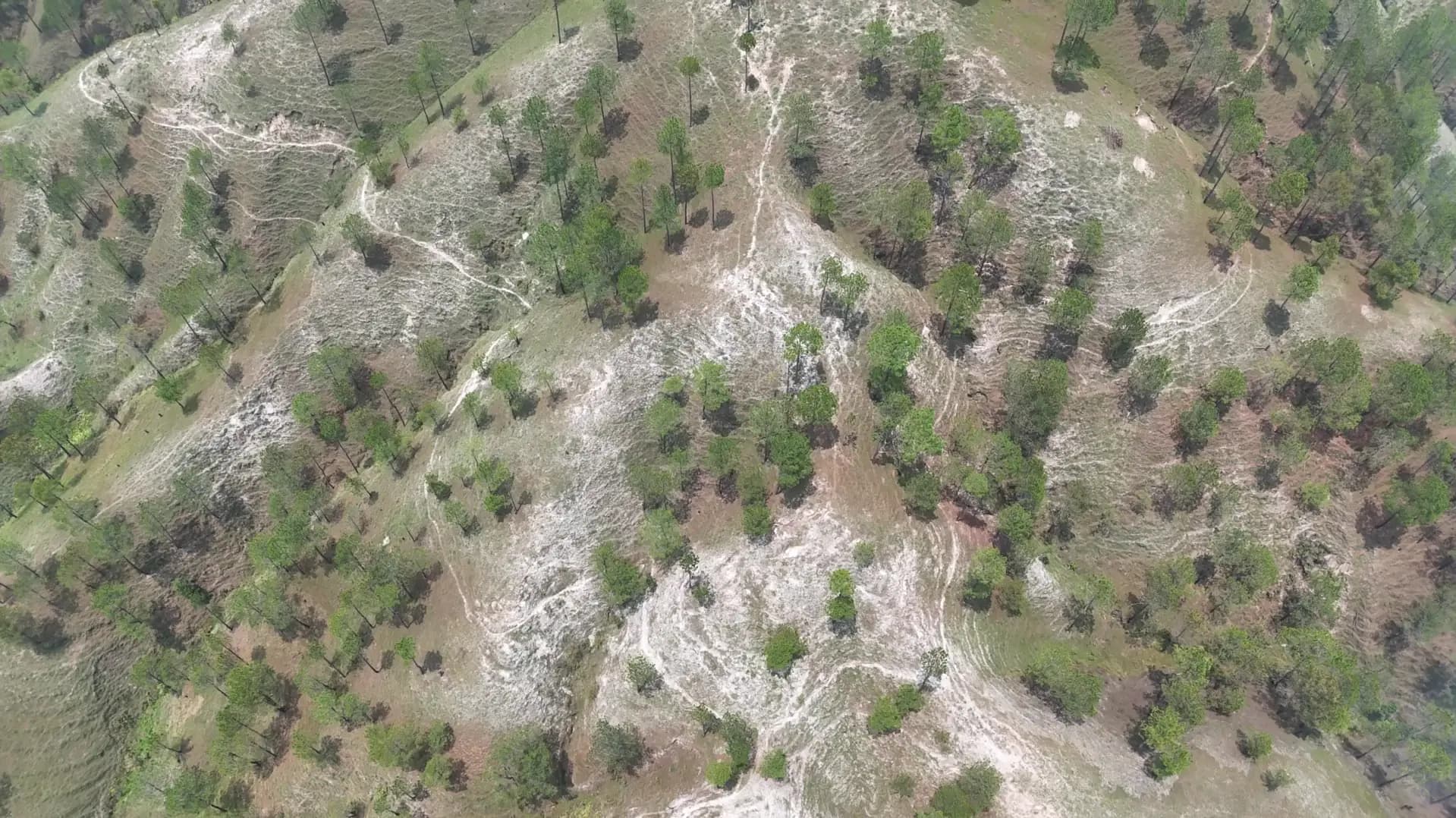
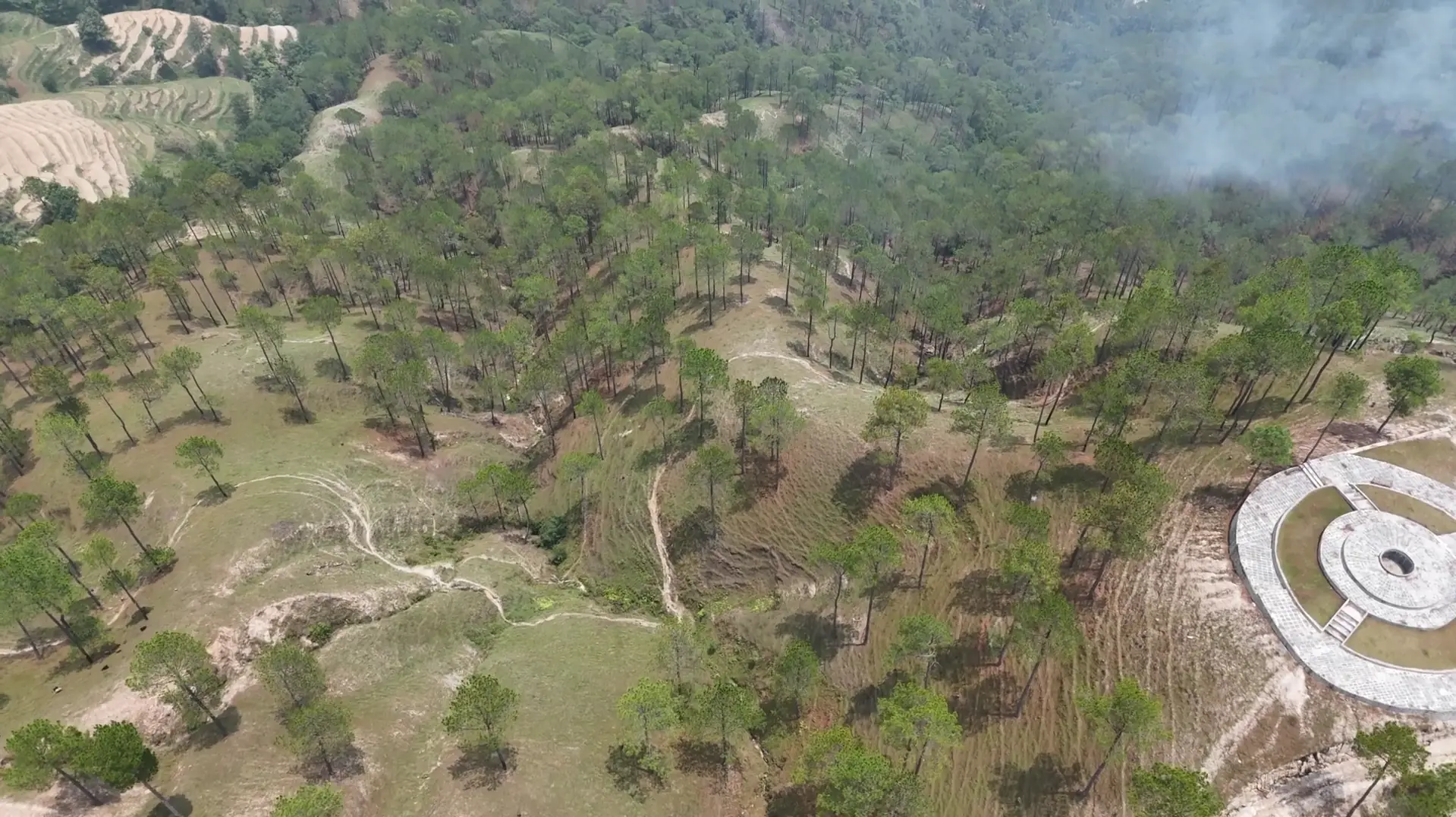
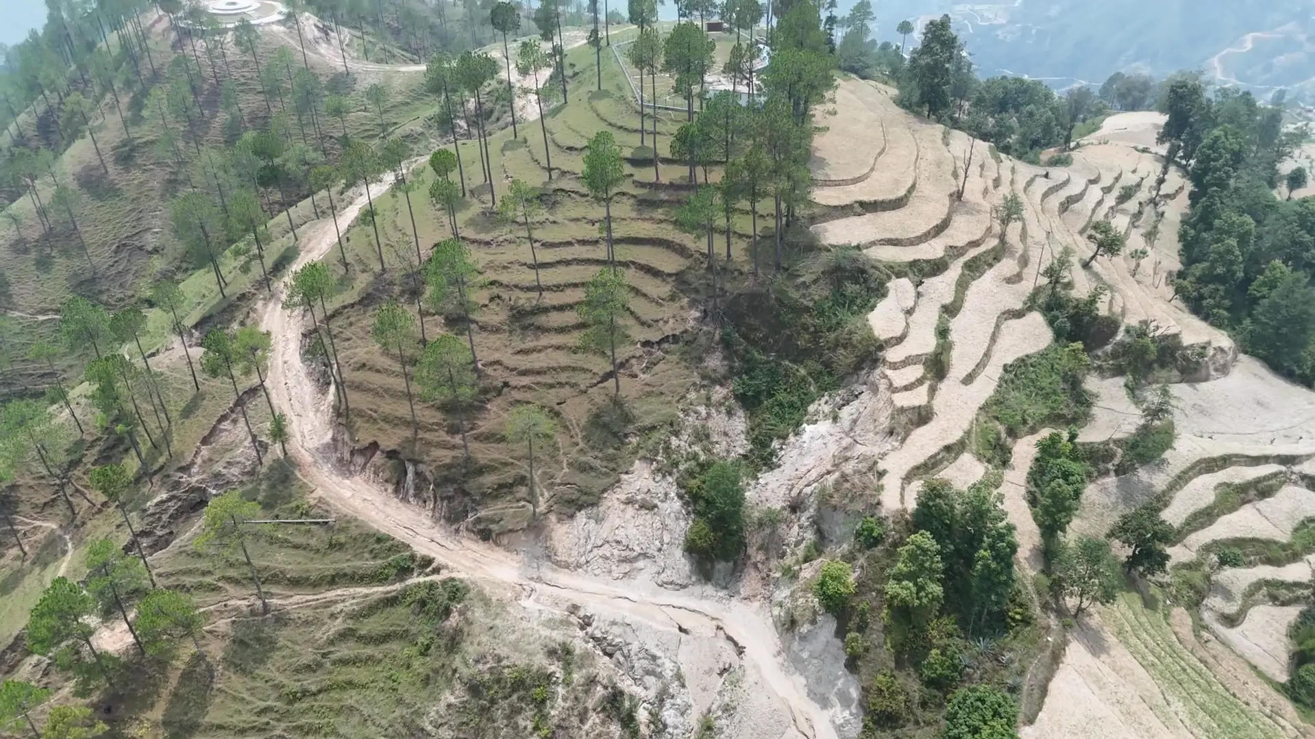
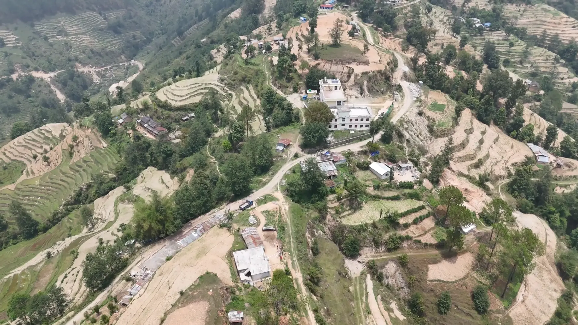
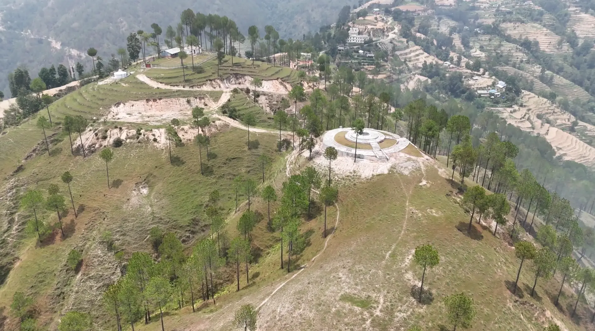
Drone footage of the site, May 2026
A hillside planted for speed, now short of water
Decades ago, pine was planted across Nepal's middle hills to cover bare slopes quickly. It did that. But pine is now widely linked to drying springs, poorer soil and dry-season fires.
In Chauthe we believe it is a major cause of the water the hills have lost, and we'll measure the change as the forest grows back in layers.
- Where
- Chauthe, Ward 3, Kakani Rural Municipality
- Area
- 150 hectares
- Elevation
- 1,200 to 1,600 m
- Managed by
- Thumki Danda Gairikharka Community Forest User Group
- Year-1 goal
- $100,000
Follow a raindrop down the hill
Scroll to see where monsoon rain goes under pine, and under a layered forest.
Monsoon rain falls on a pine hillside
Most of the year's rain arrives in a few months. What happens next depends on what covers the ground.
Pine needles shed the water
Pine needles pile up into a dry, slow-rotting mat that little grows through. Rain runs over it and carries soil downhill.
Little soaks in, so the spring fades
With less water reaching the ground below, springs that families rely on weaken in the dry season.
A layered forest drinks the rain
Under mixed trees, shrubs and ground cover, leaf litter and roots keep the soil open. Rain soaks in and feeds the spring.
Illustration. Research across the Himalaya links pine plantations with less groundwater recharge than mixed broadleaf forest; how much it matters here is what our spring and soil monitoring will show.
Year zero, on the record
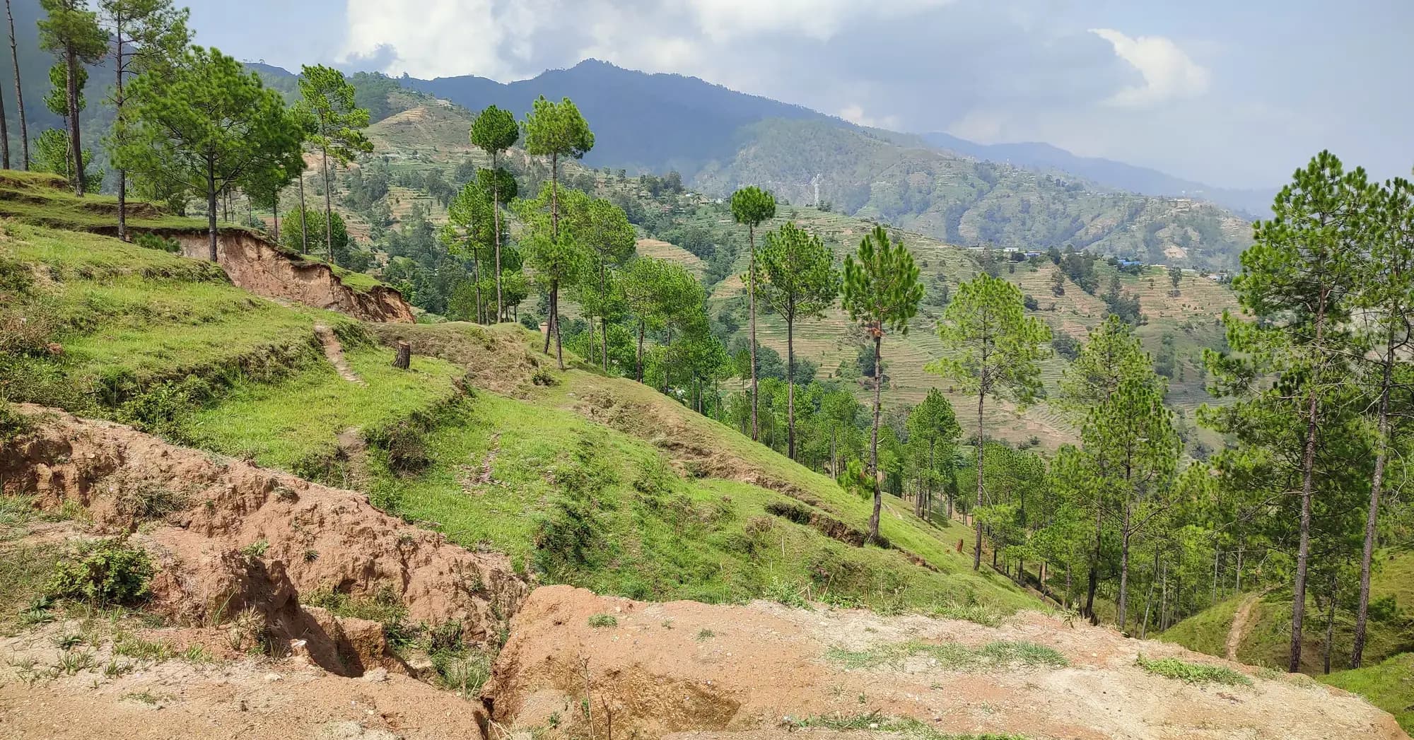
These are the hills as they are today. We'll photograph the same places every season, so anyone can see what changes, and what doesn't.
A forest that holds water and feeds people
A syntropic food forest grows in layers, the way a natural forest does. Each layer shades, feeds and protects the next, and together they keep the soil covered, open and wet.
- Tall native trees
- Fruit trees
- Shrubs and fodder
- Herbs and vegetables
- Ground cover
- Roots that open the soil
Year 1
Hold the water
Contour trenches, small check dams and recharge ponds slow the monsoon rain. Spring sources are protected, and a community nursery starts raising native and fruit trees.
Years 2 and 3
Plant in layers
Native trees, fruit, fodder and ground cover go in between the pines. Pine is thinned step by step, only where the forest user group and forest office approve.
Year 4 onward
Let the forest lead
The forest yields food, fodder and income for local families, and is managed by them. We keep measuring the springs and publishing what we find.
Timings are our plan, not a promise of results; they will shift with approvals, funding and what the land tells us.
What we'll measure, starting now
We'd rather show you numbers than promises. From year zero we will track:
- Spring flow in the dry season, at the same sources every month
- Fixed photo points on the ground and from the drone, every season
- Ground cover and soil moisture under pine and under new planting
- Trees planted and surviving, by species and by layer
Where things stand
The program is in its planning and setup stage. The site lies within community forest managed by the Thumki Danda Gairikharka Community Forest User Group, and work will proceed under the group's forest management arrangements and the local approvals it requires. A Nepal-registered not-for-profit implementing entity is being established to carry out the work on the ground.
Help the hills hold their water
Our Year-1 goal is $100,000 for the water work and the community nursery. Every gift, one-time or monthly, moves it forward, and we will report progress openly.
ZenTrust, Inc. is a 501(c)(3) public charity (EIN 33-4318487). US donations are tax-deductible as allowed by law.